
The town Los Córdobas belongs to Córdoba department and has 3 different ZIP Codes. It is recommended that you check out the map below to find if your address is inside the postal zone area.
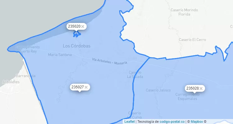
In the table below you can find all the ZIP codes of Los Córdobas and its geographical limits. By clicking on the postal code you will be able to see the specific map of it.
| ZIP Code | Postal division |  norte limit norte limit |  south limit south limit |  east limit east limit |  west limit west limit |
|---|---|---|---|---|---|
| 235020 | Urbano | Limite Urbano | Limite Urbano | Limite Urbano | Limite Urbano |
| 235027 | Rural | Mpio. Pto. Escondido y Mar Caribe | Mpio. Canalete y Arboletes | Vía Sta. R. de la Caña-Pto. Escondido | Municipio Arboletes |
| 235028 | Rural | Mpio. Pto. Escondido y Monteria | Municipio Canalete | Municipio Monteria | Vía Sta. R. de la Caña-Pto. Escondido |
Since 2009, Colombian territory is divided into postal zones, each of which has a postal code. The Colombian ZIP Code code has 6 digits, the first two digits refer to the departments, the following to regional zones and the last two digits to each municipal zone. In the case of Los Córdobas the code of the Córdoba department is 23 and the regional postal zone is 2350. To send letters or packages to Los Córdobas, Córdoba you should always use the six digit ZIP Code.
There are 3 in Los Córdobas. Check the list of ZIP codes below and the neighborhoods to which this zip code applies.
Colombia phone code is +57 and the department area code for Córdoba is 4. To make a call from outside, you must dial +57 4 phone number
Check out the list of Córdoba ZIP Code
Check the city list that also has the 235020 ZIP Code